Building Maintenance > Engineers & Surveyors
Primary services provided are:
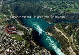
* Aerial photography, standard black and white, color and infrared.
* Digital topographic contour and plannimetric mapping.
* Digital terrain model data capture.
* Cross sectional data capture and volumetric surveys.
* Analytical bridging and aerotriangulation.
* Scanning and image manipulation.
* Digital orthophotos and mosaics.
* Color and black & white photo lab services.
* Service areas include Sacramento, Stockton, San Francisco Bay Area, Amador County, Placer County,
San Joaquin County, El Dorado County, and all of Northern California.
* Established in 1968 - American Aerial has been in business for over 40 years, building a reputation for excellence
in performing aerial surveys and photogrammetric mapping.
* Originally established by Roland Holmes.
* Currently operated by his daughter, Janice Nelson
Details
- Last Updated
- 21/Jul/2025
- Contact
- John M
- [email protected]
- Phone
- (916) 392-8676
- Website
- http://www.americanaerialmapping.com/
- Address
- 6151 Freeport Blvd Ste 170Sacramento, CA 95822
Location
Is this your business?